



GlobeViewer

Description of GlobeViewer
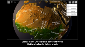
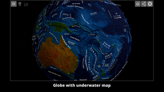
GlobeViewer is an interactive application designed to provide users with a high-quality view of the Earth's surface. This app allows users to explore the planet through a rotatable, global interface and a detailed 3D topography map. Available for the Android platform, GlobeViewer offers a unique way to visualize geographical features and data, making it an informative tool for users interested in geography, environmental science, or simply exploring the world around them. You can download GlobeViewer to start engaging with its features immediately.
The app is built upon elevation data collected by the NASA Terra probe, which has recorded elevation information from 83 degrees of both the northern and southern hemispheres between the years 2000 and 2013. This data is presented in the form of the ASTER3-DEM, providing a foundation for the app's detailed topographical representation. With the addition of version 0.10.0, GlobeViewer is enriched with approximately 7.5 million place names sourced from geonames.org. Consequently, users can identify various towns, mountains, lakes, deserts, and numerous other geographical features that are displayed on the map.
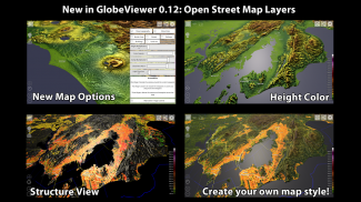
In its later version, 0.12.0, GlobeViewer incorporates data from OpenStreetMap, which includes details such as buildings, borders, and streets. This feature is particularly beneficial for users interested in urban planning or navigation, as it enhances the contextual understanding of geographical locations. However, it is important to note that access to this data is limited to demos and purchased versions of the maps.
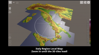
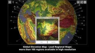
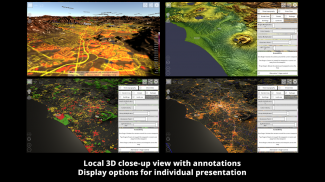
Navigating the app is straightforward, as it is divided into two main sections. The first section is a rotatable, interactive globe that allows users to spin and tilt the Earth to view different regions. The second section presents a high-resolution 3D topography map that is meticulously divided into 22,912 individual tiles. This division allows for a detailed exploration of the Earth's surface, with users able to zoom into specific areas for a closer look.
Users have the capability to load 110 different regions onto the interactive globe. This feature organizes the individual tiles in a meaningful way, enabling seamless transitions between various geographical areas. The app is designed to automatically reload these regions, ensuring a smooth user experience. Initially, GlobeViewer contains low-resolution textures for the globe, but it efficiently downloads the required high-resolution data from the server as needed. A substantial amount of data, approximately 105 GB, is available for users, and the app retains this information in the device's cache for offline use. Users also have the option to delete this cached data at any time through the main menu.
GlobeViewer is particularly useful for those interested in real-time geographical events. The app records significant occurrences, such as hurricanes and earthquakes, through integration with the Global Disaster Alert and Coordination System (GDACS). This feature allows users to stay informed about natural disasters and other critical events that impact various regions of the globe.
The application also includes a tutorial to help new users acclimate to its features quickly. For individuals looking for detailed guidance, a comprehensive manual is available, outlining the various functions included in the app. Given that GlobeViewer is still under development, users may notice that certain features are subject to change as updates are released.
The inclusion of extensive geographical data and the ability to visualize this information in a 3D format positions GlobeViewer as a valuable resource for educators, students, and anyone with a keen interest in geography. The app's commitment to providing accurate and up-to-date information ensures that users can rely on it for their geographical inquiries.
By utilizing GlobeViewer, users can immerse themselves in the exploration of our planet, gaining insights into its diverse landscapes and features. The combination of interactive elements and high-quality mapping creates an engaging experience that encourages curiosity and learning. The app is not only a tool for exploration but also a platform for understanding the complexities of the Earth’s environment.
GlobeViewer stands out for its comprehensive approach to presenting geographical data, combining interactive technology with a wealth of information. Whether for casual exploration or serious study, the app caters to a broad audience, making the world more accessible and understandable for its users. With the ability to visualize the Earth's surface in 3D, GlobeViewer offers a unique opportunity to learn about the planet in an interactive way.


